On a related note, I've been obsessed recently with grid cities. Queens, New York in particular flummoxes me. Locally every point conforms to a grid, but globally they don't all conform to the same grid. Brooklyn is comparatively easy as it consists of 4-6 large grid areas stitched together (depending how much slight bending you forgive). Big swaths of Queens like Astoria and everywhere north of Queens Blvd are also simple enough. But that region from the border with Brooklyn I just can't ever seem to summarize succinctly.
Any pattern that might form gets interrupted by either a cemetery, a park, train tracks, and in some cases (I've found out) former train tracks that were ripped out 100 years ago. I've considered theories like the streets being radially biased towards important junctions like Jamaica / Flushing. I've considered outlining major obstructions to see if those are the source of borders. I've looked around for the master plan on street numbering in Queens to no avail. This should be easy, like Manhattan Queens has numbered streets. It conforms to an approximate grid, yet no one ever plots out exactly what this grid is and where the defects in it occur.
I've always been very impressed with Seattle's relative rigor when it comes to the grid. True, the grid has one very strange aspect that's hard for newcomers to understand: it's actually nine separate grids[1], eight of which have directional qualifiers (NW, N, NE, etc) with the unqualified one covering downtown as the origin of the whole system. But most of the city and surrounding areas are pretty well committed to this grid, to the point that entire other cities are built off this "downtown seattle is the grid origin" concept (e.g. the city of Shoreline to the north starts at 145th and goes up from there). And further to the north, there's a repeat of this grid system centered on the city of Everett and extending into its surrounding cities.
One other aspect I find fascinating about Seattle's system is that there's some redundancy built into the address specification: whether the street is oriented north-south or east-west is not only indicated by whether it's an Ave (N-S) or a Street (E-W), but whether the grid qualifier is specified as a prefix or a suffix. So when you find a partial address on some album art [2], for example, you can deduce that "4718 38NE" is talking about 4718 38th Ave NE and not 4718 NE 38th St.
[1] theoretically nine grids, anyway. As an example, I'm not sure if there's actually an "E" grid. The central grid goes all the way to the water on the east, and when continued on the other side of the lake in Bellevue, the NE and SE grids touch each other.
I love navigating around Seattle so much. The grid does take a few jumps, NE 85th St in Seattle doesn't exactly line up with NE 85th St in Kirkland, (travelling straight across the lake, NE 70th St in Seattle lines up with NE 85th St in Kirkland), but in general if given an address (the first 2 or 3 digits of a house's number indicate cross street) you can navigate to almost anyplace in King County with just a compass.
FWIW there are neighborhoods that are E. The CD, Madison Valley, basically everything south of 520 until Yesler.
You also didn't mention that part of the city grid is on a 45 degree slant due to the city founders not being able to agree which grid system to use. :)
You're looking at the remnants of what used to be a bunch of unconnected Dutch settlements. New York (formerly New Amsterdam), Brooklyn, Flushing and Harlem are all named after their original Dutch counterparts, Amsterdam, Breukelen, Vlissingen and Haarlem respectively. And there is Coney Island (Konijnen eiland) and Staten Island (named after the Staten Generaal, a Dutch government body).
Once NYC expanded and engulfed all of those separate settlements the grids ended up merging and some of the connecting roads and railroads between the settlements were incorporated into the city.
Yeah I know the history. But believe it or not those grids are easy. You can make all the grids of Brooklyn out of like 6 Jigsaw pieces. There's a directly south portion that leads to the lettered Ave's all the way to CI, a "Manhattan South" portion that hugs the coast, a "Carnarsie South" portion that hugs the coast East of Coney Island, Bushwick Cheese slice, and Williamsburg offset from there. Easy Pz. The grids of Queens north of the subway are also pretty easy to split into a manageable number of jigsaw pieces, namely Astoria (follows Manhattan convention), everywhere East of LGA up to and including Flushing (true north). Its the border zone between BK and Queens that just refuses to admit a nice, simple, summary pattern. Pretty much everywhere due East of Newton Creek and/or along the lower Montauk is a mess.
Most likely this is because that particular region either had unfortunate geographical components or because the settlements there were much smaller and therefore not nicely aligned. You see a very similar thing if you look at the map of Amsterdam. The bigger developments are all nice and orderly and result in clearly recognizable patterns, but whenever the 'new' butted into the old it becomes messy.
Quite a few small towns found themselves suddenly as components of Amsterdam after being engulfed. New York in a way is relatively orderly because all of that happened in a short time.
It's fascinating stuff. Good luck with your search, I'm curious if you ever will find out what caused it.
I've looked at some really old maps. Like this one from 1853 [1]. So for starters, the Long Island Railroad is apparently eternal as its nearly impossible to find a map which pre-dates it, the modern subway lines bare remarkable resemblance to the former "plank roads", and above all the regions that I'm finding most difficult to reconcile are actually younger not older than the other grids that have been stitched together.
This helpful tool [2] highlights what I mean. Zoom out and look around, its mostly consistent large jigsaw pieces. There's just this one turbulent maelstrom in the middle that ruins the idea of several grids glued.
Could it have been some large company that held the land and put their own buildings on it? There are some regions around here that are as large as the cities they border but are private land, Hoogovens (now Tata Steel) in IJmuiden is one of those and near Rotterdam there is 'Pernis'. Inside those it is a huge jumble. Other options: swamp land, native American settlements, army installations. Bushwick loosely translated is 'Boswijk' aka forest borough, so the area may have been heavily forested. The roads there may then have been logging roads rather than roads for regular traffic.
>Could it have been some large company that held the land and put their own buildings on it?
Coincidentally that describes an area a bit north of where I'm focusing called "Rego park". Where does the name Rego come from? Was it what the Native Americans called it before the settlers arrived? Was it the name of some important person in history? Nope. None of those. The company that developed the area was called "Real Good Realty". Rego is a contraction of REal GOod. Yep, its that stupid. But Rego Park is still grid conforming.
There's a bunch of strangely curving streets a bit East of Rego Park in a crescent shape starting at 63rd St. Those are bending around the (now abandon and overgrown) tracks of the LIRR Far Rockaway branch. That line continues straight South exactly tangent to the curve. There's a few other places on the map where long gone rail lines influenced streets, but those mostly form minor exceptions to grid rules rather than full on dissolution.
You're right Bushwick was absolutely Forrest from what I've read. But Bushwick itself is actually pretty grid conforming. Its approximately rectangular and slightly rotated relative to Bedstuy on its left side. The difficult parts start just above Bushwick. Namely around Ridgewood, Glendale, Maspeth and Middle village.
Queens is unusual in the sense of having developed incredibly recently. Like literally farm land as recently as the 50s in some parts. Logically it should be the most conforming to the overall street plans, yet it isn't. Yeah there's natural borders like those cemeteries, but if it had streets running along the edges of the cemeteries the result would be a square layout leading exactly to a grid! Its almost like someone went out of their way to avoid making sense!
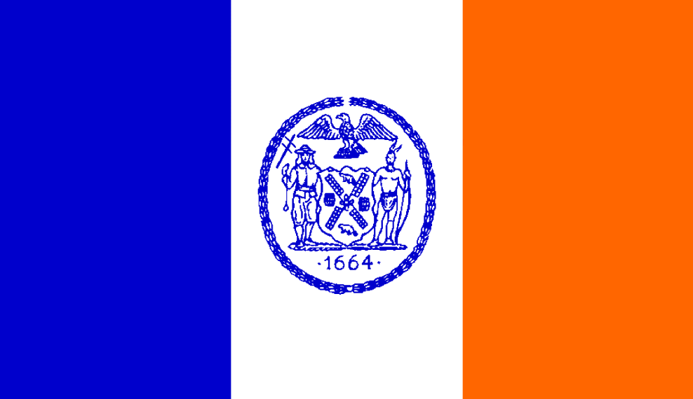
BTW since you're interested there's quite a few place names you missed in NYC where the influence of the Dutch settlers can be seen. New Utrecht Ave, Dyker Heights, Stupyen Duvil, Yonkers, Van Ness, Van Wyck...probably more but those are the ones I can think of off hand. There's also the flag of the city [1] which still has the blue-white-orange banner of the Dutch crown (albeit vertical rather than horizontal). I've been told in recent times that particular tri-color pattern has an unfortunate association with far right political movements. Is it true?
> New Utrecht Ave, Dyker Heights, Stupyen Duvil, Yonkers, Van Ness, Van Wyck...
I'm aware of them, just figured the point had been made. There are indeed quite a lot more of them if you know how to look for them. The degree to which they have been bastardized sometimes makes it harder to spot them.
> There's also the flag of the city [1] which still has the blue-white-orange banner of the Dutch crown (albeit vertical rather than horizontal). I've been told in recent times that particular tri-color pattern has an unfortunate association with far right political movements.
The 'Prinsenvlag' (the non rotated version) is indeed associated with the NSB, the Dutch Nationalist Socialist Movement which during World War II made nice with the Nazis and whose name is pretty much synonymous with 'traitor'. In more recent times it has been associated with the PVV another right wing party with nationalist tendencies.
If you zoom it it gets less neat. In the Williamsburg/Greenpoint area you can see 5 different grids. All of them historically from different settlements.
Williamsburg/Greenpoint is several pizza slices of grid arranged in a semicircle around a common corner. Sure its 5 minor grids but its still very much a simple pattern to summarize
There's a bit of history between the current state and the original Dutch settlements.
Unlike Brooklyn, which was its own independent city for a while before merging into New York City, Queens was a county consisting of several distinct towns. So for example Flushing and Long Island city were two separate municipalities. It's not too surprising that they were developed differently.
What I think is more fascinating is just how enormous Queens actually is. I've always wanted to learn more about why it seemed like a good idea to unify such a large area into one physical city. Same goes for Staten Island. Would be really interesting to read some primary sources from the time.
The major impetus for unification was the promise to build the subway. Manhattan had the money but needed the land, Brooklyn and Queens had land but not the wealth.
Once upon a time Flushing was hyper religious Quakers. When the NY & Flushing RR was built (today the Port Washington branch of LIRR), one of the anecdotes in its history was the moral outcry when they tried to run a single train per day on Sunday. They appointed actual fun police to make sure no rowdy drunkards would dare come to their town hoping to have a good time. What do they think this is, Brooklyn? LIC was literally built by and for the railroads. Before the tunnels into Manhattan (1906 IIRC), you would get off the LIRR (or other competing services which were later bought out) and switch to a ferry to cross the East river at Hunters Point. LIC was always de facto colonization by Manhattanites.
> Once upon a time Flushing was hyper religious Quakers.
That's not surprising given that the town of Vlissingen that it is named after in NL is also in part of what is called the Dutch Bible Belt. Zeeland has a very strong religious tradition, even today. Likely those that came to America and named their town Flushing (likely phonetically much closer to Vlissingen in those days) were from there.
On a related note, lots of businesses on Manhattan still don't get it. They advertise their location as something like:
58th St 369
instead of saying:
58th St 369 btw. 6th and 7th Av
It would be so much easier for their customers to reach them if they stated between which streets, or which avenues their particular street-number is located.
Yes I know there are formulas you can memorize to figure out cross streets but you're a business, you're supposed to be trying to make this easy for me.
If you're located on a grid and you advertise an address without giving cross streets, I guess you don't actually want my business.
"True" New Yorkers seem to have memorized which numbers are between which numbered Avenues --- at least my son has done this since moving there first for college, then a job.
This is one of those 90/10 rule things where just learning a post-it note worth of trivia covers you for over 90% of instances. I'm sure he's competent at navigating especially in the ordinary places reachable by ordinary subway ride. The corner that flummoxes me is that inexplicable void in the map. The big empty part of the subway system sandwiched between the EFMR and JMZ lines. That curious combination of Newton Creek, Highland park, an archipelago of like a dozen large cemeteries, more than a few heavy industrial zones, and freight rail tracks. I've seen parts of the map in this no mans land where numbered Ave's just straight up skip over a half dozen other numbers which I know exist elsewhere on the map. However the grid was zippered together, there is a seam in it and this is it.
There is actually an official algorithm for estimating the cross streets given any address within the Manhattan grid. I don't know if it still is, but it used to be published in fine print on bus system maps. It's a little too complicated to memorize, but you could easily keep it on a note card in your wallet and do the calculations in your head or with your phone calculator.
Right. Manhattan grid. That's easy. I'm talking about the grid in Queens. In particular the middle of Queens. It becomes extremely non-grid conforming in a way a calculator rule can't fix.
I can do this in Amsterdam as well, but there it is a lot more complicated, especially on the canals. But I usually can aim for the right block just knowing the house number, and even/odd says which side of the street or canal to be on.
Aren't addresses in Manhattan mostly east or west of 5th Ave, each avenue incrementing by 100? Meaning 369W is between 8th and 9th, while 369E between 2nd and 1st?
Building numbers ascend in the same direction as streets / avenues and usually the hundreds digit is incremented at the corner so that building 369 is (ideally) between 3rd and 4th. Something similar to that. Double check me on this. Its been a while but the relation between building number and location on the grid is def linear.
Much of NYC started off as small, independent towns and villages with their own grids. Bushwick. Williamsburg. Flushing. Their grid were determined by things like angle of the coast, internal geographic features, or just random chance. As they grew, they grew together and fused as best they could.
Bushwick, Williamsburg, and Flushing all conform to a reasonably sized jigsaw piece of locally consistent grid. Bushwick is a Cheese wedge between Fulton and Broadway. Williamsburg is approximately several (smaller) pizza slices with the crust along the coast line. Flushing is basically true north/south grid.
Large fractions of Brooklyn and Queens are consistent-enough to approximate most of the landmass as perhaps a dozen jig saw pieces. Nothing you said is news to me. But this border area, primarily Ridgewood and Maspeth, it refuses to be consistent enough to draw a jigsaw piece over it.
This is The Thing about Manhattan: it’s a very rigorous grid (except for some parts below Houston) but then it has this big diagonal — but irregular — gash across the grid. Manhattan without the grid would be London or Lisbon or any other Old World river city warren; the grid gives it its New World power. But without Broadway, it would be boring.
In Utah we use blocks from Main Street and State Street (to really over simplify). So, I live at 4475 W and 5500 S. Which is to say that I’m about 45 blocks West of Main Street and 55 blocks South of State street.
Any pattern that might form gets interrupted by either a cemetery, a park, train tracks, and in some cases (I've found out) former train tracks that were ripped out 100 years ago. I've considered theories like the streets being radially biased towards important junctions like Jamaica / Flushing. I've considered outlining major obstructions to see if those are the source of borders. I've looked around for the master plan on street numbering in Queens to no avail. This should be easy, like Manhattan Queens has numbered streets. It conforms to an approximate grid, yet no one ever plots out exactly what this grid is and where the defects in it occur.
WTF IS QUEENS GRID?!?!